Sample Images
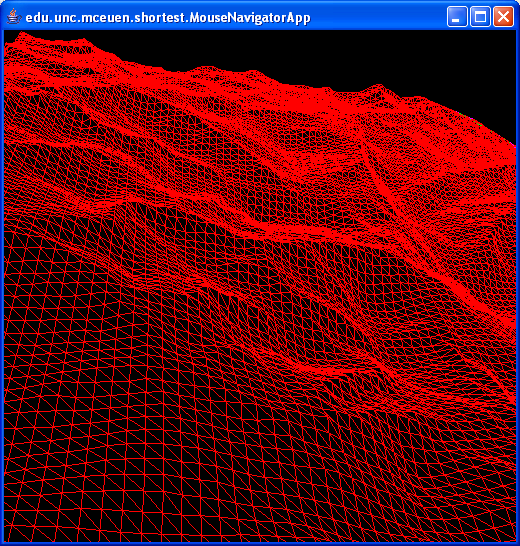
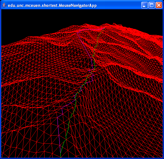
These images show raster data from a DEM converted to a TIN. The choice of the direction for the diagonal inside grid squares is arbitrary. The first image shows an overview of the terrain. The z-values have been scaled by a factor of 5. In the second image, the purple path traces the shortest path found using only the edges that were in the original graph. The green path traces the shortest path found on the graph where each edge has been augmented by 2 steiner points.- Overview of terrain:
- Shortest paths:
Attachment  | Action | Size | Date | Who | Comment |
|---|---|---|---|---|---|
| | manage | 69.3 K | 02 May 2005 - 15:19 | HenryMcEuen | |
| | manage | 61.1 K | 02 May 2005 - 15:19 | HenryMcEuen |
Revision: r1.1 - 02 May 2005 - 15:20 - Main.guest