TModeling
Start of topic | Skip to actions
20 Foot DEM Data
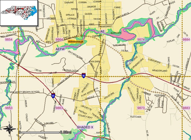
The following DEMs are from an area around Hillsborough (see the overview map below for details). The data is from ncfloodmaps.com and is in text format. The data is attached below in text and TIFF format. The conversion from text to TIFF was done with ArcGIS. The numbers on the files correspond to the shaded numbers in the center of each tile on the overview map.- This sample shows the first few lines of one of the DEM files in text format.
- Overview map of area around Hillsborough:
 -- HenryMcEuen - 08 Feb 2005
to top
I  | Attachment  | Action | Size | Date | Who | Comment |
|---|---|---|---|---|---|---|
| | hillsborough_overview.PNG | manage | 677.6 K | 08 Feb 2005 - 20:27 | HenryMcEuen | Overview map of area around Hillsborough |
| | dem9863_copyraster.tif | manage | 978.3 K | 08 Feb 2005 - 22:35 | HenryMcEuen | |
| | dem9864_copyraster.tif | manage | 978.3 K | 08 Feb 2005 - 22:35 | HenryMcEuen | |
| | dem9873_copyraster.tif | manage | 978.3 K | 08 Feb 2005 - 22:36 | HenryMcEuen | |
| | dem9874_copyraster.tif | manage | 978.3 K | 08 Feb 2005 - 22:37 | HenryMcEuen | |
| | dem9863.txt | manage | 1926.8 K | 08 Feb 2005 - 22:38 | HenryMcEuen | |
| | dem9864.txt | manage | 1926.7 K | 08 Feb 2005 - 22:39 | HenryMcEuen | |
| | dem9873.txt | manage | 1926.6 K | 08 Feb 2005 - 22:40 | HenryMcEuen | |
| | dem9874.txt | manage | 1926.9 K | 08 Feb 2005 - 22:41 | HenryMcEuen | |
| | demsample.txt | manage | 19.4 K | 08 Feb 2005 - 22:57 | HenryMcEuen | Sample showing format of DEM text data |
Edit | Attach image or document | Printable version | Raw text | More topic actions
Revisions: | r1.2 | > | r1.1 | Total page history | Backlinks
Revisions: | r1.2 | > | r1.1 | Total page history | Backlinks